of anthropogenic emissions could be sequestered by soils over 25 years.
FAQ
Detection of sustainable agriculture practices for carbon markets
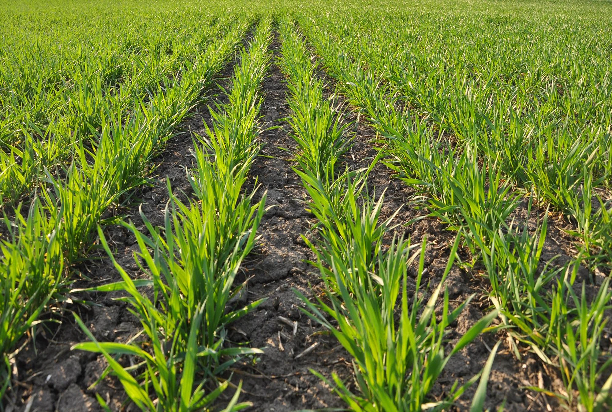
Regenerative farming is an approach to agriculture that focuses on restoring and enhancing the health of soil, ecosystems, and biodiversity while maintaining productive food systems. Instead of relying heavily on external inputs such as synthetic fertilizers and pesticides, regenerative practices emphasize techniques like crop rotation, cover cropping, reduced tillage, composting, and integrating livestock to rebuild soil organic matter and improve water retention.
By strengthening natural ecological processes, regenerative farming aims to increase farm resilience, protect local biodiversity and ecosystems and capture carbon in soils, a process known as soil carbon sequestration which is the basis of a practice called “carbon farming”. Carbon farming” can be thought of as forming part of the holistic regenerative agriculture approach. Carbon farming has the specific aim of capturing and storing carbon in soils and vegetation to reduce atmospheric CO₂. This stored carbon can be measured and converted into carbon credits, which can be sold to organisations seeking to offset their greenhouse gas emissions. As a result, additional revenue can be gained for those who practice it, such as farmers or carbon farming project developers. A carbon farming project developer is an organisation or entity that designs, implements, and manages agricultural projects that increase carbon sequestration in soils or vegetation.
Verification of carbon farming practices has traditionally depended heavily on farmer self-reporting. Programmes and auditors have relied on handwritten records, complex documentation, and occasional on-site inspections to confirm that soil-building methods were actually in place. This process has been slow, resource-intensive, and sometimes uncertain, particularly across large portfolios.
Moreover, for carbon farming project developers, recent policy drivers are pushing for more stringent operations. The Carbon Removal Certification Framework (CRCF) establishes the EU-wide voluntary standards that will define what qualifies as a certified carbon removal or carbon farming activity. It introduces requirements for monitoring, reporting, verification (MRV), additionality, permanence, and sustainability safeguards. For developers, this means higher expectations around data quality, risk management, and transparency but also greater market clarity and credibility. Projects aligned with CRCF standards will be better positioned to access EU-compliant buyers, reduce regulatory uncertainty, and differentiate themselves in a market increasingly focused on integrity and measurable climate impact.
Envato
Introducing EO
In order to verify sustainable practices and carbon farming activities are taking place and are effective in the sequestration of carbon in soils, monitoring of agricultural lands is required.
Monitoring has typically relied on field visits, farmer reporting, and periodic sampling that cover only part of the landscape. It is very costly to physically assess every field, creating blind spots in both risk management and carbon credit verification. A carbon credit is a tradable certificate representing one metric tonne of carbon dioxide (CO₂) or equivalent greenhouse gases that has been reduced, removed, or avoided, which can be used by organisations to offset their emissions. These carbon credits are traded in carbon markets where companies, governments, or other organisations buy and sell verified credits to offset their greenhouse gas emissions or meet climate targets.
The emergence of Earth Observation has transformed this landscape. Satellites now capture complementary data on vegetation structure, soil disturbance, moisture levels, and biomass production. By analysing these signals, sustainable practices can be verified directly from space and changes in soil-health indicators can be tracked over time. This enables objective, scalable, and continuous verification of soil carbon-enhancing practices; reducing reliance on self-reporting and manual audits, strengthening credit integrity, and enabling more trustworthy climate-smart agriculture programs.

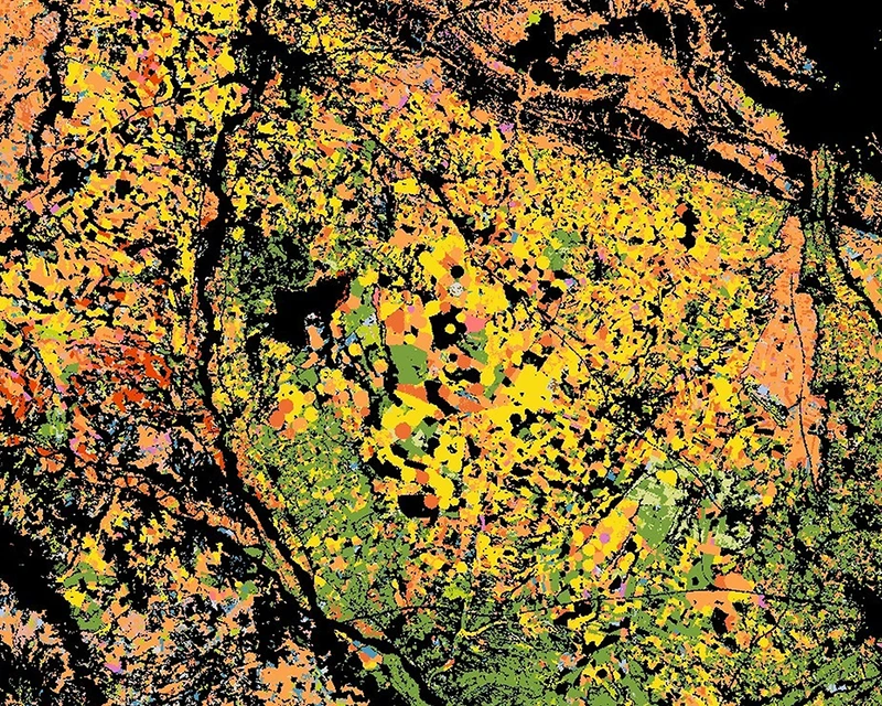
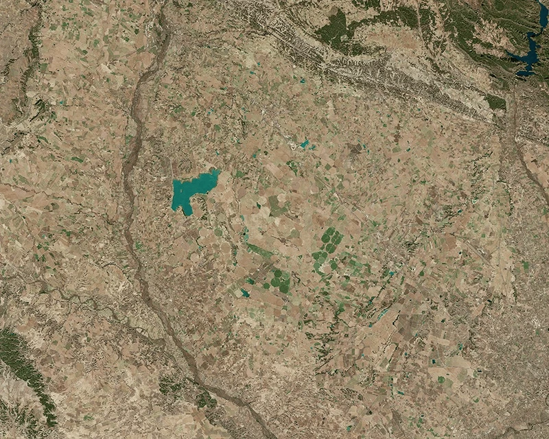
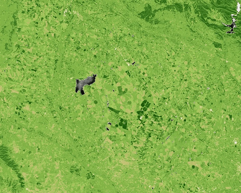
Here we see Sentinel-2 imagery in Spain in 2022. Crop types can be identified using the likes of Normalized Difference Vegetation Index (NDVI) and machine learning to analyse seasonal growth patterns, enabling large-scale monitoring of practices like crop rotation and cover cropping that improve soil health. Moreover, the Copernicus Land Monitoring Service (CLMS) datasets can show crop type classifications changing over time due to seasonal rotations. The yearly updated High Resolution Layer Croplands also supports tracking historic crop rotation practices. (Spain) - source
Sustainable practices
Sustainable agricultural practices focus on restoring soil health, increasing biodiversity, improving water retention, and enhancing long-term farm resilience – all of which can contribute to carbon sequestration in agricultural lands.
Many sustainable practices exist, some of which also help sequester carbon, such as cover cropping, reduced or no tillage, diversified crop rotations or agroforestry:
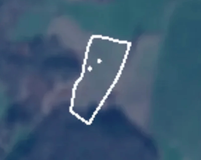
Using satellite time series data from Sentinel-1, Sentinel-2 and other sources, models can be built to detect and monitor the level tillage activity. Here we see a tillage event being detected. The field turns “yellow” after the tillage activity has happened. By reducing tillage activity, soil disruption is limited, encouraging the storage of carbon in the soil. (Germany) - source
- Cover cropping is the practice of planting crops primarily to protect and improve soil health—rather than for harvest—by reducing erosion, enhancing soil fertility, and increasing organic matter.
- Reduced or no tillage is a farming practice that minimises or eliminates soil disturbance during planting, helping preserve soil structure and increase soil carbon storage.
- Crop rotation is the practice of growing different types of crops sequentially on the same field across seasons or years to improve soil health, manage pests and diseases, and maintain long-term agricultural productivity.
- Agroforestry is a land-management practice that integrates trees and shrubs with crops or livestock on the same land to enhance biodiversity, improve soil health, and increase carbon sequestration.
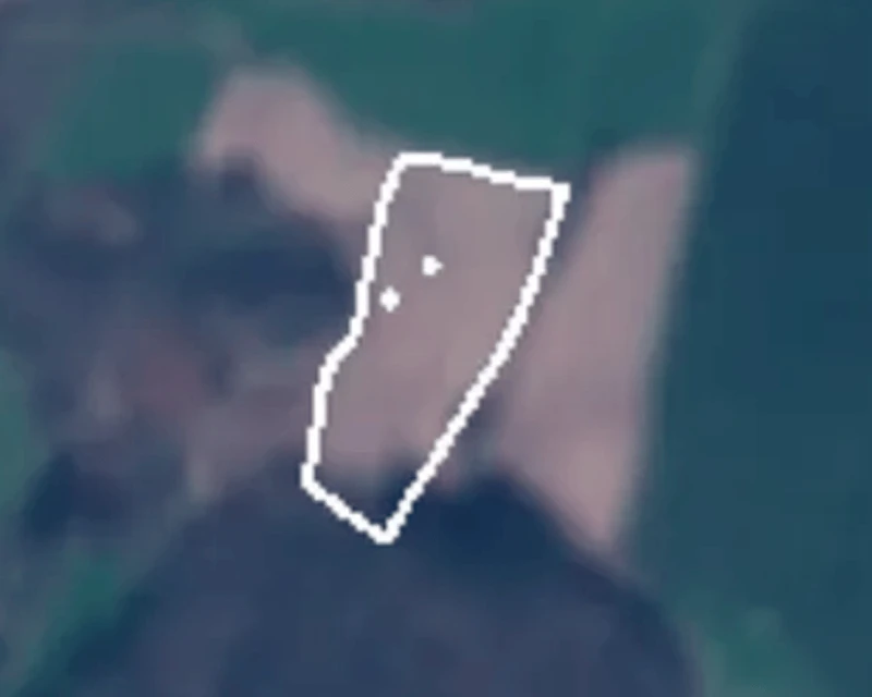
Using satellite time series data from Sentinel-1, Sentinel-2 and other sources, models can be built to detect and monitor the level tillage activity. Here we see a tillage event being detected. The field turns “yellow” after the tillage activity has happened. By reducing tillage activity, soil disruption is limited, encouraging the storage of carbon in the soil. (Germany) - source
Copernicus offers powerful data sources which can be used to monitor sustainable practices:
- Sentinel-2’s multispectral imagery enables tracking of vegetation cover, crop diversity, and seasonal dynamics using indices such as Normalised Difference Vegetation Index (NDVI) and Normalized Difference Red Edge Index (NDRE), which can reveal continuous ground cover, biomass growth, and crop rotation patterns.
- Sentinel-1’s radar data penetrates cloud cover and is sensitive to soil moisture and surface structure, making it well suited to assessing reduced tillage, soil disturbance, and moisture retention.
- Sentinel-3 further complements these observations by offering land surface temperature which can provide context for regional climate influences on agricultural productivity.
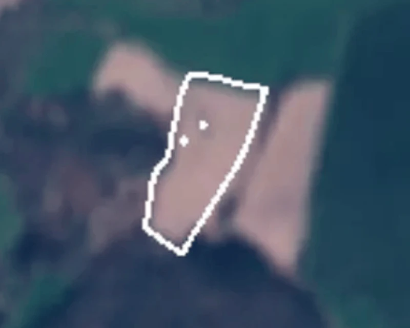
Using satellite time series data from Sentinel-1, Sentinel-2 and other sources, models can be built to detect and monitor the level tillage activity. Here we see a tillage event being detected. The field turns “yellow” after the tillage activity has happened. By reducing tillage activity, soil disruption is limited, encouraging the storage of carbon in the soil. (Germany) - source
Detecting agricultural activity events
Sudden increases or decreases in derived indices can indicate agricultural activity events. For example, a sharp decrease in NDVI may indicate a crop harvest or tillage event. Time-series analysis of these indices allows for the identification of timing and progression of field operations.
Sentinel-1 can complement this analysis by providing Synthetic Aperture Radar (SAR) data that is independent of cloud cover and daylight conditions. Sentinel-1 radar backscatter is highly sensitive to surface roughness, soil moisture, and crop structure, making it particularly useful for detecting mechanical field operations. Therefore, changes in radar backscatter can reveal tillage events, even during cloudy periods when optical imagery is unavailable. Combining Sentinel-1 SAR measurements with Sentinel-2 vegetation indices improves the reliability and temporal continuity of farming event detection, enabling more robust monitoring of agricultural practices across different weather conditions.
The figure presented illustrates how analysing NDVI time series data can help identify agricultural events. In this illustrative example, we see tillage events in Germany were detected around day of year (DOY) 110 and again near DOY 280. Both events are marked by a sharp decline in NDVI values, reflecting the sudden reduction in vegetation cover in the field. When combined with additional data sources, this information can be used to train automated tillage detection models.
Source: kappazeta.ee
Continuous and automated monitoring
Carbon farming verifiers are independent third parties that assess and confirm the accuracy of emission reductions or carbon sequestration claims made by carbon farming project developers, ensuring the resulting carbon credits are credible and meet certification standards. By using EO to analyse vegetation indices, soil cover, moisture, biomass, and disturbance patterns over time, verifiers can detect sustainable practices, track productivity, and spot early signs of potential reversal. This temporal evidence strengthens proof of additionality, durability, and effective risk management.
This approach is particularly relevant under the Carbon Removal Certification Framework (CRCF), which places strong emphasis on robust monitoring, reporting, and verification (MRV), permanence, and transparency.
Automated services are being developed by integrating continuous satellite data streams with parcel boundaries, weather data, and project metadata into a structured processing pipeline. After pre-processing and harmonisation, time series features—such as seasonal biomass peaks, soil exposure frequency, and disturbance indicators—can be extracted at the field level. Machine learning models can then classify management practices, detect transitions, and flag anomalies that may signal risk events.

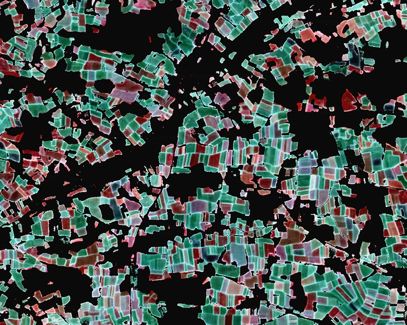
Solutions can be developed which utilise Sentinel data to detect and monitor the practice of cover cropping. Different types of crops can be detected based on the specific spectral reflectances measured combined with other information such as phenological data on seasonal crop cycles. Cover crops are plants used to protect and improve the soil at times when cash crops are not being grown. Source
Sustainable Agriculture Dashboard
Copernicus data can be integrated into interactive dashboard overviews, enabling users to monitor, assess, and track a wide range of sustainable agriculture practices, including soil health, crop cover, and various biodiversity indicators over time. An illustrative exampe of such a dashboard is shown here.
CLMS / ERA5
Copernicus data products and services offer a suite of tools that can act as contributing data sources to carbon sequestration monitoring activities.
For instance, the Copernicus Land Monitoring Service (CLMS) provides land cover maps and time-series data. These products enable the detailed tracking of crop development, vegetation indices (e.g., NDVI and LAI), and changes in land management practices which are all critical parameters for assessing soil organic carbon (SOC) sequestration.
ERA5, produced by the European Centre for Medium-Range Weather Forecasts under the Copernicus Climate Change Service, provides consistent historical and near-real-time climate data including temperature, rainfall, soil moisture, and evapotranspiration. This information helps assess drought risk, heat stress, and water availability; key factors influencing sustainable practices.
When combined with satellite and in-situ data, it strengthens MRV of soil health and carbon sequestration.

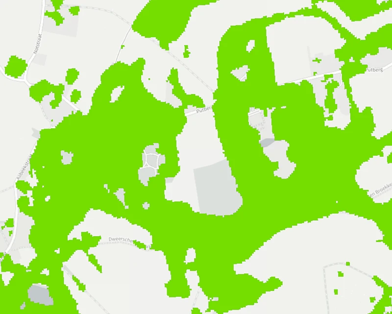
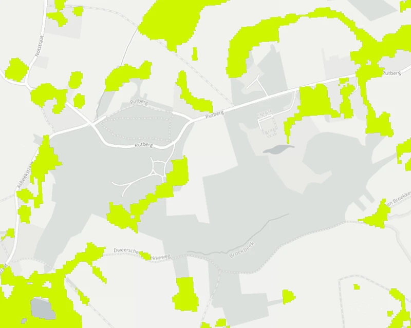
Here we see Copernicus Land Monitoring Service (CLMS) layers showing small woody features (i.e., hedgerows, shrubs, and small tree groups) in yellow and woody vegetation (i.e.,larger trees) in green in an active agroforestry initiative in Belgium. These products can act as harmonised data sources which can contribute to establishing baselines in support of project-level agroforestry assessments as well as wider applications, such as the development of national inventories. (Belgium) - source
Who benefits
from Copernicus?
Carbon farming project developers need scalable, cost-effective ways to verify that sustainable farming practices are implemented and contributing to carbon sequestration. Using Copernicus and Sentinel data, they can monitor land management, support MRV processes, and reduce verification costs.
Farmers can benefit significantly from having their sustainable agriculture practices and carbon farming activities independently verified, as this enables them to quantify and demonstrate the environmental value of their actions. Verification can lead to the generation of certified carbon credits. These credits can then be sold on carbon markets, providing farmers with an additional and potentially long-term source of income.
Sustainable agriculture and carbon farming can deliver important benefits for local communities by supporting more sustainable rural economies and strengthening long-term environmental resilience. As farmers adopt practices that improve soil health, biodiversity, and water quality, surrounding communities can benefit from healthier ecosystems, reduced pollution, and improved landscape management. Additional farm income generated through carbon credits and sustainability programmes can help keep farms economically viable, supporting local businesses and services that depend on the agricultural sector.
Other stakeholders who benefit from more robust activity monitoring are certification bodies, policymakers, researchers, and carbon market participants involved in the monitoring, verification, and financing of carbon removal and soil carbon activities.
Explore this
further with us
Copernicus Sentinel data and many Copernicus service products are free and openly available, making it easier to scale monitoring.
EUSPA can support stakeholders by helping identify fit-for-purpose Copernicus datasets, designing meaningful indicators, and connecting with EO service providers to operationalise dashboards, reporting and alerts.